Lady Bird Lake & Butler Trail Complete Guide
The 10-mile urban loop connecting downtown Austin to the water, plus bridges, kayak access, and 1.5 million bats
#1 ABoR Team 2024$1B+ Career Sales1,000+ Homes Sold
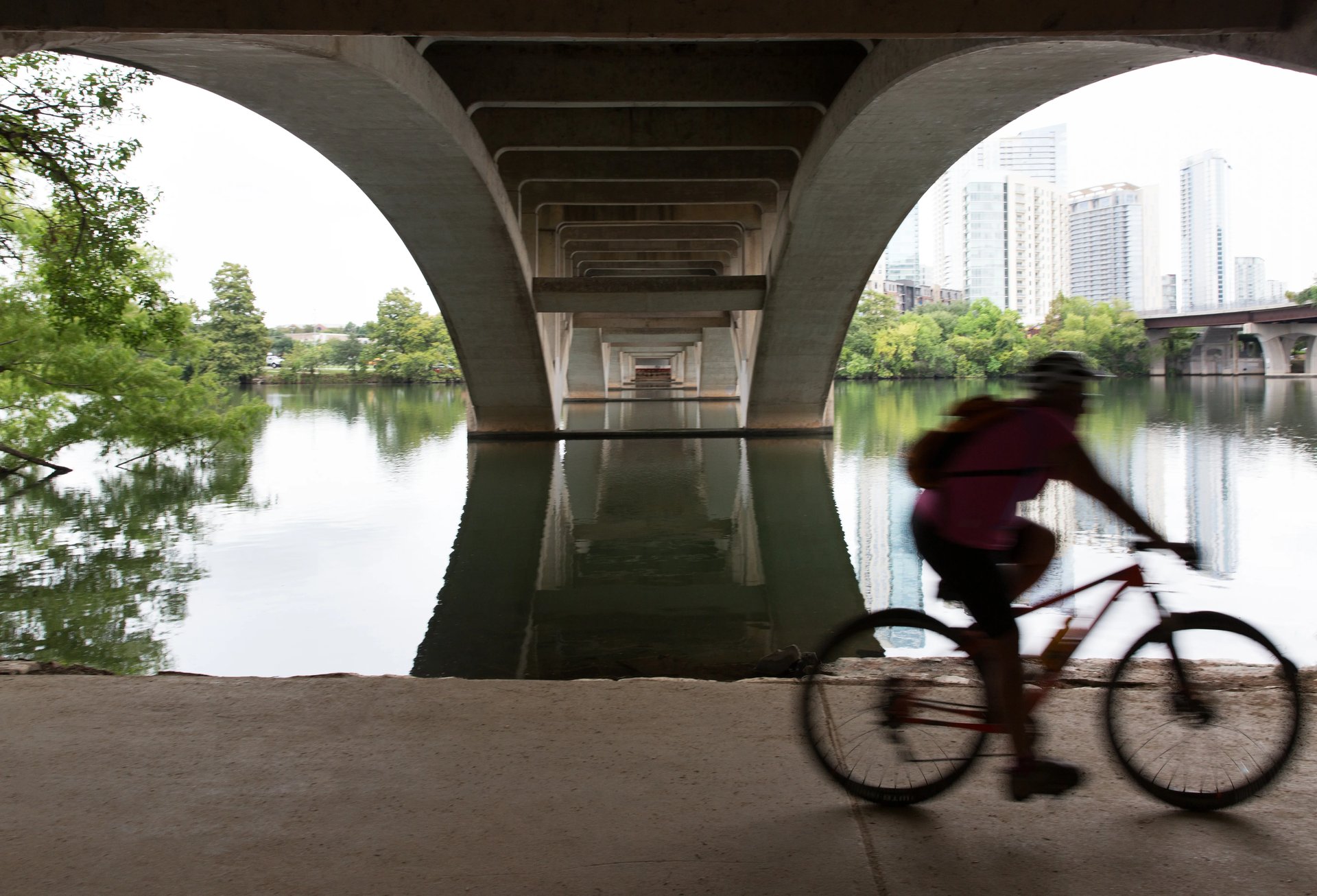
Lady Bird Lake is a reservoir on the Colorado River running through the center of Austin, and the Butler Trail is the 10-mile crushed granite and concrete loop that circles it. This is not a wilderness trail. It is the connective tissue of urban Austin - the path that links downtown condos to South Congress bungalows, rowing clubs to bat colonies, and office workers to their lunch-hour runs. On any given morning you will see sculling crews launching before dawn, runners doing tempo work on the Boardwalk, and dog walkers staking out the shaded sections near Rowing Dock. The trail is flat, well-maintained, and almost entirely shaded on the south bank. For buyers looking at downtown, Travis Heights, Bouldin Creek, or Zilker, this loop is the backyard. It is also the single most-used trail in Central Texas, so expect company.
Trail Map
Full Butler Trail Loop
Highlights
- Complete loop around Lady Bird Lake with skyline views
- Mix of crushed granite and concrete surfaces
- Multiple water fountains and restrooms along the route
- Shade cover on most of the south bank
Parking
Multiple lots along Cesar Chavez, Stratford Drive, or Lou Neff Point. Street parking on South Lakeshore Blvd (free but competitive on weekends).
Local Tip
Run counterclockwise starting from Pfluger Bridge to get the exposed north bank section done early before the sun gets high. The south bank shade makes the second half much more comfortable.
Boardwalk to Congress Bridge
Highlights
- Lady Bird Lake Boardwalk - the newest section of the trail
- Over-water walking with lake and skyline views
- Direct view of the Congress Bridge bat colony at sunset
- ADA accessible throughout
Parking
Lot at East Bouldin Creek (off Riverside Drive) or street parking on South Lakeshore Blvd.
Local Tip
The bat emergence happens at dusk from mid-March through October. Get to Congress Bridge by 7:30 PM in summer and watch from the southeast corner for the best viewing angle. The bats spiral out heading east.
Rowing Dock to Red Bud Isle
Highlights
- Rowing Dock kayak and SUP rentals
- Red Bud Isle off-leash dog area at the trail's end
- Quieter western section away from downtown crowds
- Views of the MoPac bridge and western hills
Parking
Rowing Dock lot on Stratford Drive (small, fills by 9 AM on weekends). Overflow parking at Walsh Boat Landing.
Local Tip
Rent a kayak at Rowing Dock and paddle west toward Red Bud Isle. You will see turtles stacked on every log and great blue herons in the shallows. Morning paddles before 9 AM are almost private.
Auditorium Shores Loop
Highlights
- Best skyline photography angle in Austin
- Off-leash dog park along the south shore
- Flat open fields for picnics
- Direct connection to the Long Center and Palmer Events Center
Parking
Auditorium Shores parking lot off Riverside Drive. Free on weekdays, metered on weekends during events.
Local Tip
The sunrise from Auditorium Shores looking northeast across the lake toward downtown is the shot you see on every Austin postcard. Get there 20 minutes before sunrise for the best light on the skyline.
Deep Eddy to Pfluger Bridge
Highlights
- Deep Eddy Pool - the oldest swimming pool in Texas (spring-fed, open year-round)
- Shaded trail section under large pecan trees
- Views of rowing and sculling teams on the lake
- Connects to Zilker Park and Barton Springs at the east end
Parking
Deep Eddy Pool parking lot on Deep Eddy Avenue. Additional street parking on Lake Austin Blvd.
Local Tip
Deep Eddy charges $5 per adult but it is spring-fed and stays around 70 degrees year-round. Swim first, then walk the trail east to Pfluger Bridge and back. Total time is about 2 hours including the swim.
Nearby Neighborhoods
Looking for a home near these trails? These neighborhoods have the best access.