Skip to content
Keenan Group
Austin Trails & Running Routes - Keenan Group Austin Real Estate

Austin Trails & Running Routes

The best hiking and running trails in Austin

#1 ABoR Team 2024$1B+ Career Sales1,000+ Homes Sold

What are the best neighborhoods in Austin for trail access?

Barton Creek, Zilker, Travis Heights, and Westlake Hills offer the most direct greenbelt and trail access in Austin. Barton Creek residents can walk to the 12.7-mile Barton Creek Greenbelt. Zilker sits at the trailhead of the 10.1-mile Ann and Roy Butler Trail around Lady Bird Lake. Northwest Hills connects to the 30,000-acre Balcones Canyonlands Preserve. Travis Heights has direct lakeside trail access on foot.

  • Barton Creek Greenbelt: 12.7 miles, swimming holes, rock climbing
  • Lady Bird Lake Trail: 10.1-mile paved loop, accessible from Zilker and Travis Heights
  • Balcones Canyonlands: 30,000+ acres, accessible from Northwest Hills and Great Hills
  • Wild Basin Preserve: 2.5-mile loop in Westlake Hills, managed by St. Edwards University

Source: The Keenan Group, #1 Austin Board of Realtors Team (2024)

Running Austin: A Trail Runner's Guide to Neighborhoods

I've been running Austin's trails for over 20 years. When clients ask me about outdoor access, I don't pull up a map - I describe the route I ran that morning.

Austin is one of the best trail running cities in the country. You have a 10-mile paved lakeside loop, a 12-mile limestone canyon system, and 30,000 acres of Hill Country preserve - all within city limits. The trail you run tells you the neighborhood you want.

If you want flat, fast miles with skyline views, you want the Lady Bird Lake Trail - which means Travis Heights, Zilker, or downtown. If you want technical singletrack through limestone canyons, you want the Barton Creek Greenbelt - which means Barton Creek, Barton Hills, or Lost Creek. If you want creek crossings and canyon trails, Northwest Hills puts you 5 minutes from Bull Creek.

Here are the routes I run most and the neighborhoods they connect to.

What are the best trail running routes in Austin?

The Lady Bird Lake Trail (10.1-mile paved loop) is Austin's top urban running route - flat, scenic, and accessible from Travis Heights, Zilker, and downtown. For trail running, the Barton Creek Greenbelt offers 12.7 miles of rocky limestone singletrack. Shoal Creek Trail (3.2 miles, paved) runs north-south through Clarksville. Bull Creek adds a 2.1-mile trail running loop with creek crossings near Northwest Hills.

  • Lady Bird Lake Trail: 10.1 miles, paved, flat, water fountains every half mile
  • Barton Creek Greenbelt: 12.7 miles, rocky limestone, 200-400 ft elevation gain
  • Shoal Creek Trail: 3.2 miles, paved, shaded, connects downtown to 38th Street
  • Bull Creek + St. Edwards Park: 4.2 miles combined, creek crossings, canyon terrain

Source: The Keenan Group, #1 Austin Board of Realtors Team (2024)

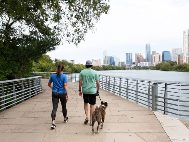
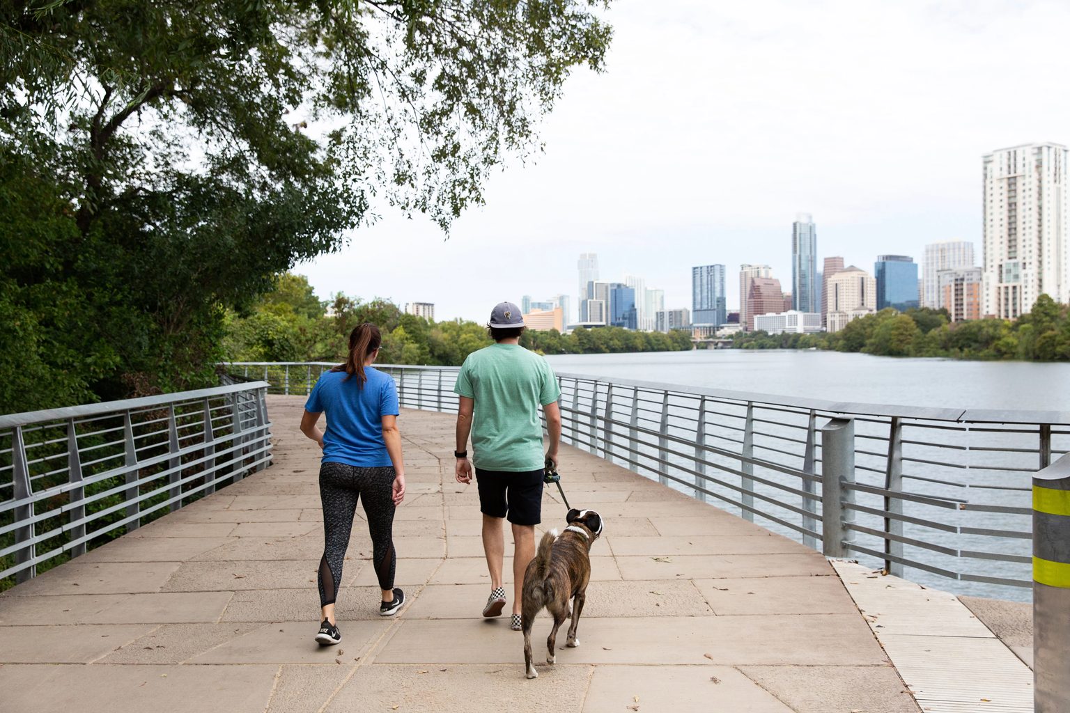
Lady Bird Lake boardwalk trail in Travis Heights Austin

Lady Bird Lake Trail (Ann & Roy Butler Trail)

10.1-mile loopEasyPaved, crushed granite sections

Flat - less than 100 ft total gain

Best for: Tempo runs, long runs, all levels

  • One of the top urban running routes in the U.S.
  • Full loop around Lady Bird Lake with downtown skyline views
  • Boardwalk section over the water (completed 2014)
  • Water fountains and restrooms every half mile

Nearby neighborhoods

This is my go-to weekday run. I park at the Lamar trailhead and do the full loop in under 80 minutes. The stretch from the Boardwalk to Zilker at sunrise is the best running in Austin.

Joe Keenan, Broker Associate

Barton Creek Greenbelt limestone trail in Barton Hills Austin

Barton Creek Greenbelt

12.7 miles point-to-pointModerateRocky limestone, dirt singletrack

Rolling - 200-400 ft gain depending on section

Best for: Trail running, technical terrain, hill training

  • Austin's signature trail system through limestone canyon
  • Gus Fruh to Sculpture Falls is the best running section (3.4 mi round trip)
  • Creek crossings after rain - check conditions before you go
  • Multiple trailheads: Gus Fruh, Spyglass, Hill of Life

Nearby neighborhoods

The Greenbelt is where I go for real trail running. Rocky, technical, and completely different from road running. Start at Gus Fruh and head south toward Sculpture Falls. You'll forget you're in a city of 2 million people.

Joe Keenan, Broker Associate

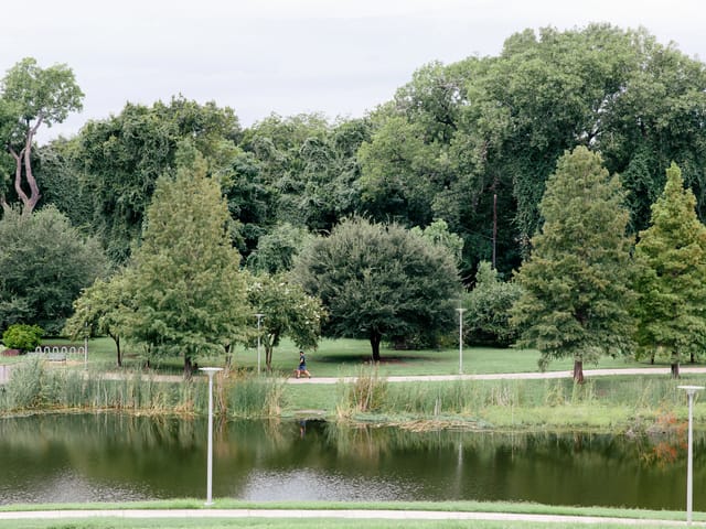
Central Austin park and urban trail setting near Shoal Creek

Shoal Creek Trail

3.2 miles one-wayEasyPaved

Flat with gentle grade

Best for: Easy runs, recovery days, commute running

  • Runs north-south through central Austin
  • Tree-lined corridor with good shade year-round
  • Connects downtown to 38th Street district
  • Minimal road crossings

Nearby neighborhoods

ClarksvilleOld West AustinTarrytown
Bull Creek trail and limestone creek bed in Northwest Hills Austin

Bull Creek District Park

2.1-mile loopModerateDirt, limestone, creek crossings

100 ft gain

Best for: Short trail runs, creek running, hill repeats

  • Limestone creek bed running when water is low
  • Shaded canyon trail with dense tree cover
  • St. Edwards Park connects for longer runs (add 2.1 miles)
  • Swimming holes in summer months

Nearby neighborhoods

Northwest HillsGreat Hills

I tell every runner moving to Northwest Hills: Bull Creek is your neighborhood trail. Five minutes from your door, and you can string together Bull Creek plus St. Edwards Park for a solid 4+ mile loop with creek crossings.

Joe Keenan, Broker Associate

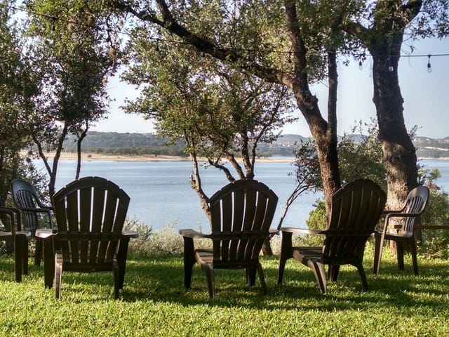
Lake Travis Hill Country landscape near Emma Long and Turkey Creek

Turkey Creek Trail at Emma Long

2.3-mile loopChallengingDirt singletrack through canyon

250 ft gain

Best for: Hill training, canyon running, solitude

  • Rugged canyon terrain in the Balcones Canyonlands
  • Creek crossings and exposed limestone ledges
  • Connects to City Park Road trail system
  • Far less crowded than Barton Creek Greenbelt

Nearby neighborhoods

Mountain Biking Trails in Austin

Austin's mountain biking scene centers on a handful of well-maintained trail systems, ranging from beginner-friendly loops to technical limestone singletrack.

Walnut Creek Metropolitan Park

13+ miles singletrackModerate

The most popular mountain biking park in Austin. Well-maintained trail system with good signage, a beginner loop, intermediate and advanced options, and night riding permitted with lights. North Austin location.

Barton Creek Greenbelt

12.7 milesChallenging

Austin's most technical mountain biking. Limestone rock gardens require solid bike handling. The Hill of Life climb is a rite of passage for Austin cyclists. Best after a dry spell - slippery when wet. Closest from Barton Hills and Barton Creek.

Pace Bend Park

8+ milesModerate

Trails on a peninsula in Lake Travis with a mix of wooded singletrack and open ridge riding. Swimming access after your ride. Travis County park with $10 day use fee. Closest from Lakeway.

McKinney Falls State Park

3.1-mile loop + connectorsEasy

Beginner-friendly mountain biking in a state park setting, 15 minutes from downtown. The Onion Creek loop is rideable for most skill levels. Waterfall views at Upper and Lower McKinney Falls. Connects to the longer Onion Creek trail system.

Dog-Friendly Trails & Off-Leash Parks in Austin

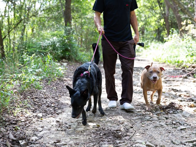
Austin is one of the most dog-friendly cities in the country. Every major trail system allows leashed dogs, and the city maintains dedicated off-leash areas with water access, shade, and room to run. If your dog is part of the home search (and it usually is), here's where to look.

Red Bud Isle

Off-leash

13-acre island in Lake Austin. Completely off-leash with deep water swimming, shaded trails looping the island, and room for dogs to run. The most popular dog destination in Austin - small parking lot fills fast on weekends. Go early or on weekdays.

Zilker Park Off-Leash Area

Off-leash

Large grassy area along Barton Creek with creek access for swimming, shaded sections under pecan trees, and adjacency to Zilker Park proper and the botanical garden. One of the most popular dog areas in central Austin.

Bull Creek Off-Leash Area

Off-leash

Creek swimming with shallow and deep sections in a limestone creek bed. Surrounded by wooded trails with multiple access points. One of the best creek swimming spots for dogs in Austin.

Northwest HillsGreat Hills

Auditorium Shores Off-Leash

Off-leash

Lady Bird Lake access with downtown skyline as your backdrop. Open grassy area for fetch adjacent to the Butler Trail for on-leash walking. Walkable from downtown condos and Bouldin Creek.

Norwood Dog Park

Off-leash

Fenced off-leash area with separate sections for large and small dogs, water stations, and shade structures. Walking distance from South Congress restaurants.

Onion Creek District Park

Off-leash

The largest off-leash area in Austin at 12 acres. Rolling terrain with mature trees and creek access. Southeast Austin location means fewer crowds. Popular with families in Circle C and Shady Hollow.

Scenic Walks, Family Hikes & Swimming Holes

Not every outdoor activity needs to be a workout. Austin has some of the best scenic walks, easy family hikes, and natural swimming holes in Texas - and most are 15 minutes or less from the neighborhoods our clients look at.

Walks & Easy Hikes

Mount Bonnell

0.3 miles (106 stone steps)

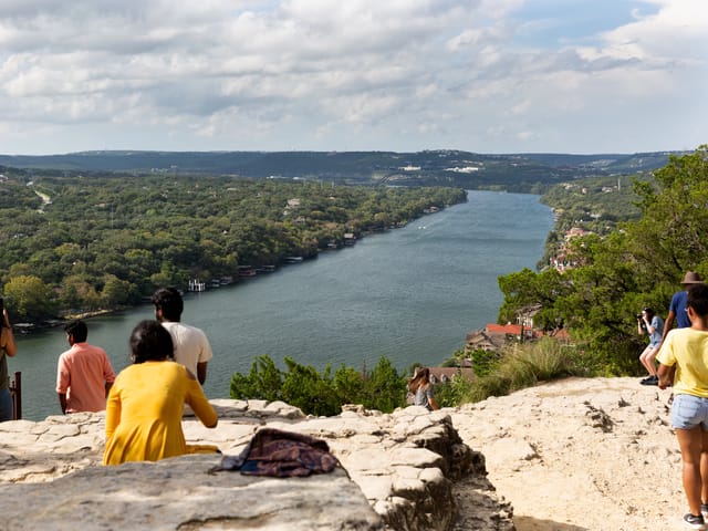
Highest point in Austin city limits at 775 feet. Panoramic views of Lake Austin, the Pennybacker (360) Bridge, and the Hill Country. Short but steep - best at sunrise or sunset. 5 minutes from Tarrytown.

Wild Basin Wilderness Preserve

2.5 miles of trails

Easy, well-marked loop trails through Hill Country terrain. Managed by St. Edward's University. Seasonal waterfall after rain. Interpretive trail signs for kids. Westlake Hills families walk here year-round. Small entry fee.

Lady Bird Johnson Wildflower Center

4.5 miles of trails

Native Texas plant gardens and restored savanna managed by UT Austin. Seasonal wildflower displays peak March through May. Family-friendly with a cafe and gift shop. Southwest Austin off La Crosse Ave.

Mayfield Park & Nature Preserve

1.3 miles

Free-roaming peacocks and peafowl in historic cottage gardens. Shaded creek-side trails adjacent to Laguna Gloria art museum. A local favorite near Tarrytown. Free admission.

Swimming Holes & Creek Access

Barton Springs Pool

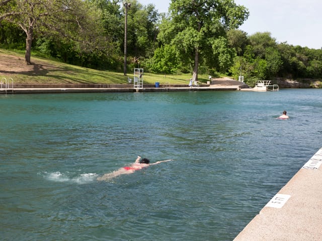
68 degrees year-round. 3-acre spring-fed pool in Zilker Park, fed by the Edwards Aquifer. Open daily, $5-$9 entry. One of Austin's most iconic landmarks and a reason people move here. Walk from Zilker or Barton Hills.

Sculpture Falls

Natural swimming hole in the Barton Creek Greenbelt with flat limestone ledges for lounging. Waterfall feature after rain. Free, no entry fee. 1.7-mile hike from the Gus Fruh trailhead on Barton Hills Drive. Moderate terrain.

Campbell's Hole

Deep swimming hole along Barton Creek with limestone cliffs for jumping. Short hike from the Spyglass trailhead off the Barton Creek Greenbelt. Popular with UT students and locals on warm weekends.

Hamilton Pool Preserve

50-foot waterfall into a natural grotto pool. One of the most photographed spots in Texas. Travis County nature preserve 30 miles west of Austin. Reservations required year-round via Travis County Parks. Worth the drive.

All Austin Trails & Parks by Neighborhood

Comprehensive trail data pulled from our neighborhood guides, formatted for scanning by trailhead, nearby neighborhoods, best-use tags, map links, and verified source links.

Avery Ranch

183A Shared Use Path

Verified 2026-03-27

6+ miles along 183A toll road, easy, biking_commuting A paved multi-use path running alongside the 183A toll road

runningbikingfamilies

Bouldin Creek · Bryker Woods · Downtown Austin · Downtown Condos · East Austin · Hyde Park · Rollingwood · South Congress · Zilker

Ann and Roy Butler Hike-and-Bike Trail

Verified 2026-03-27

Access via Zilker Park, 2100 Barton Springs Rd, Austin, TX 78704

10-mile loop, Easy, Paved multi-use trail The crown jewel of Austin's trail system

runninghikingbiking

Barton Hills · Cherrywood · Old Enfield · Rosedale

Ann and Roy Butler Hike-and-Bike Trail

Verified 2026-03-27

Access via Zilker Park, Austin, TX 78704

10.1 miles (full loop), Easy, Hike & Bike Trail Austin's signature urban trail loops around Lady Bird Lake

runninghikingbiking

Travis Heights

Ann and Roy Butler Hike-and-Bike Trail

Verified 2026-03-27

14.6-mile loop, Easy, Paved Multi-Use Trail Austin's signature trail loops around Lady Bird Lake, and Travis Heights sits right above the south shore

runninghikingbiking

East Holly

Ann and Roy Butler Hike-and-Bike Trail (Holly Segment)

Verified 2026-03-27

10 miles (full loop); Holly segment ~1.5 miles, Easy, Paved multi-use trail The crown jewel of Austin trails runs right along Holly's southern edge at Lady Bird Lake

runninghikingbiking

Avery Ranch

Avery Ranch Internal Trail System

Verified 2026-03-27

6+ miles of connected paths, easy, walking_biking Avery Ranch was designed so you can walk or bike between neighborhoods without crossing a major road

hikingbikingswimming

UT Golf Club

Balcones Canyonlands Preserve

Allandale · Great Hills · Northwest Hills

Balcones District Park

Verified 2026-03-27

1-mile loop plus connector trails, easy_to_moderate, park_trails 51 acres with a one-mile loop trail (half paved, half natural surface), basketball and volleyball courts, a playground, and Balcones Pool

hikinggolffamilies

Brentwood · Westover Hills

Balcones District Park Trails

Verified 2026-03-27

1 mile of paved and natural trails, Easy, Walking / Nature Paved pathways and short nature trails through the park, connecting the pool, playgrounds, basketball courts, and pavilion areas

hikingswimmingfamilies

Barton Hills

Barking Springs (Off-Leash Swimming)

Verified 2026-03-27

2201 William Barton Dr (downstream side), Austin, TX 78746

Easy, swimming_dogs The unofficial free swimming area just downstream from Barton Springs Pool, where the spring runoff creates a shallower, warmer pool

runningswimmingdog walking

Cherrywood

Bartholomew District Park

Verified 2026-03-27

Multiple trails across 57 acres, Easy, District Park 57-acre park just north of the neighborhood with a municipal pool (free admission), playground, picnic areas, and sports facilities

swimmingfamilies

Mueller

Bartholomew District Park Trails

Verified 2026-03-27

1.0 mile (internal loop), easy, park_trails 57-acre district park with shaded walking paths, sports fields, and a free public swimming pool with two slides and a diving board

hikingswimmingfamilies

Barton Creek · Bouldin Creek · Pemberton Heights · Zilker

Barton Creek Greenbelt

Verified 2026-03-27

12+ miles of trails, Easy to Moderate, Natural hiking/biking trail Over 12 miles of limestone trails following Barton Creek south and west from Zilker Park

hikingswimmingfamilies

Canyon Ranch

Barton Creek Greenbelt - Camp Craft Trailhead

Verified 2026-03-27

1710 Camp Craft Rd, Austin, TX 78746

Variable - up to 12 miles one way on the full Greenbelt, easy_to_moderate, hiking_swimming The closest Greenbelt access point for Barton Creek West residents

hikingswimmingfamilies

Rollingwood

Barton Creek Greenbelt - Gus Fruh Access

Verified 2026-03-27

2642 Barton Hills Dr, Austin, TX 78704

3.0 miles round trip, moderate, hiking / swimming The closest Greenbelt access to Rollingwood and the fastest route to Campbell's Hole, the best swimming hole on the creek

swimming

Barton Hills

Barton Creek Greenbelt - Gus Fruh Access

Verified 2026-03-27

2642 Barton Hills Dr, Austin, TX 78704

Access to 12+ mile trail system, Moderate (rocky descent to creek), hiking_swimming_climbing This is THE reason people pay a premium to live in Barton Hills

hikingswimming

Lost Creek

Barton Creek Greenbelt - Loop 360 Access

Verified 2026-03-27

7.25 miles total greenbelt, Moderate, Hiking / Mountain Biking / Swimming The main access point for the Barton Creek Greenbelt, with the best parking along the trail system

runninghikingswimming

Austin Country Club · Davenport Ranch · Four Seasons at Lake Austin · Rob Roy

Barton Creek Greenbelt - Loop 360 Trailhead

Verified 2026-03-27

7.9 miles end-to-end, Moderate, Creek / Swimming Holes / Multi-Use Over 7 miles of trail through limestone canyons following Barton Creek

runninghikingswimming

Flintrock Falls

Barton Creek Greenbelt - Sculpture Falls

Verified 2026-03-27

4.2 miles out-and-back, Moderate, Hiking / Swimming Austin's most popular greenbelt trail with natural swimming holes when the creek is flowing

hikingswimming

Westlake Hills

Barton Creek Greenbelt - Sculpture Falls

Verified 2026-03-27

3.2 miles out-and-back, Moderate, hiking / swimming Access the Greenbelt from the Westlake side via Scottish Woods Trail off 360

hikingswimming

Barton Hills

Barton Creek Greenbelt - Spyglass Access

Verified 2026-03-27

1601 Spyglass Dr, Austin, TX 78746

Access to 12+ mile trail system, Moderate, hiking The second Greenbelt access point closest to Barton Hills

hiking

Rollingwood

Barton Creek Greenbelt - Spyglass Trailhead

Verified 2026-03-27

1601 Spyglass Dr, Austin, TX 78746

2.5 miles round trip, easy to moderate, hiking The Spyglass access drops you onto the main Greenbelt trail with options to head east toward Zilker or west toward the wilder upper sections

hikingdog walkingfamilies

Circle C Ranch · Circle C Ranch

Barton Creek Greenbelt (South Access)

Verified 2026-03-27

12+ miles, Moderate to Difficult, Natural Surface - Hike, Bike, Swim Austin's signature greenbelt is accessible from the south via MoPac

hikingbikingswimming

Barton Creek · Canyon Ranch · Davenport Ranch

Barton Creek Habitat Preserve

Verified 2026-03-27

Adjacent to Barton Creek West off Hwy 71, Austin, TX 78735

4 miles of trails, Moderate, Nature Preserve / Hiking 4,083-acre Nature Conservancy preserve protecting golden-cheeked warbler habitat

outdoorsweekend reset

Barton Hills · Bouldin Creek · Downtown Austin · Downtown Condos · Lost Creek · Rollingwood · South Congress · Tarrytown

Barton Springs Pool

Verified 2026-03-27

2201 Barton Springs Rd, Austin, TX 78746

3 acres, Easy, Natural spring-fed swimming pool A 68-degree spring-fed pool in Zilker Park that holds about 32 million gallons

swimmingfamilies

Zilker

Barton Springs Pool Walkway

Verified 2026-03-27

0.5 miles, Easy, Walking / Nature The tree-lined path connecting the Barton Springs Pool entrance to the surrounding park and creek areas

swimmingfamilies

Canyon Ranch · Flintrock Falls · Sweetwater

Bee Cave Central Park

Verified 2026-03-27

13742 Bee Cave Pkwy, Bee Cave, TX 78738

1.5 miles loop, Easy, Park / Walking Trails Family-friendly park with paved walking trails, a playground, and open green space

hikingdog walkingfamilies

Serene Hills

Bee Cave Central Park Perimeter Trail

Verified 2026-03-27

1 mile, Easy, Walking / Running Paved perimeter trail just west of the 620 and Bee Cave Parkway intersection

runninghikingfamilies

Bee Cave

Bee Cave Central Park Trail

Verified 2026-03-27

1.4-mile loop, Easy, Walking / Running / Biking Paved 1-mile concrete trail through 50 acres of grasslands and live oaks

runninghikingdog walking

Sweetwater

Bee Cave Hike & Bike Trail

Verified 2026-03-27

1.5 miles, Easy, Paved Multi-Use Trail Connects Falconhead Blvd south along 620 to Central Park and then to the Hill Country Galleria

runninghikingbiking

Bee Cave

Bee Cave Multi-Use Trail

Verified 2026-03-27

1.5 miles, Easy, Biking / Walking / Running Paved connector trail from Falconhead Boulevard south along 620 to Central Park and onward to the Galleria

runninghikingbiking

Serene Hills

Bee Cave Park Loop

Verified 2026-03-27

1.4 miles, Easy, Hiking / Walking Paved loop trail at Bee Cave City Park with a 4.6-star rating on AllTrails

hikingdog walkingfamilies

Bee Cave

Bee Cave Sculpture Park

Verified 2026-03-27

7-acre park, Easy, Walking / Art A hidden cultural asset most visitors miss

families

Rob Roy

Bee Creek Trail at Lost Creek

Verified 2026-03-27

1.5 miles, Easy, Neighborhood Trail / Walking A paved neighborhood trail that runs through the Lost Creek subdivision adjacent to Rob Roy

runninghikingfamilies

Allandale · Northwest Hills

Beverly S. Sheffield Northwest District Park Trails

Verified 2026-03-27

1.2 miles of paved and natural trails, easy, urban park The neighborhood's backyard park at 7000 Ardath St

hikingfamilies

Travis Heights

Big Stacy Park

Verified 2026-03-27

Easy, Neighborhood Park / Swimming The heart of Travis Heights outdoor life

swimmingfamilies

South Congress

Big Stacy Park & Pool

Verified 2026-03-27

23-acre park, Easy, Neighborhood Park / Swimming Austin's only free and heated public pool sits at the south end of Stacy Park along Blunn Creek

hikingswimmingfamilies

Driftwood Golf Ranch Club

Blue Hole Regional Park

Verified 2026-03-27

1.5 miles of trails, Easy, Hiking / Swimming A spring-fed swimming hole on Cypress Creek in Wimberley with towering cypress trees and rope swings

hikingswimmingfamilies

Bouldin Creek

Blunn Creek Greenbelt

Verified 2026-03-27

1.5 miles, Easy to Moderate, Natural hiking trail A quieter trail on the east side of South Congress running through St

runninghikingfamilies

South Congress · Travis Heights

Blunn Creek Greenbelt Trail

Verified 2026-03-27

0.88 miles, Easy, Urban Hiking Trail A shaded urban trail connecting Little Stacy Park to Big Stacy Park through the Travis Heights neighborhood

hikingdog walkingfamilies

South Congress · Travis Heights

Blunn Creek Nature Preserve

Verified 2026-03-27

40 acres, Moderate, Nature Preserve / Hiking Across from St

hiking

East Austin

Boggy Creek Greenbelt

Verified 2026-03-27

1.6 miles, Easy, Nature trail / Creek A ribbon of green cutting through East Austin neighborhoods

runninghikingdog walking

Cherrywood · East Holly

Boggy Creek Greenbelt Trail

Verified 2026-03-27

2.6 miles, Easy, Urban creek trail A shaded corridor along Boggy Creek with oaks, pecans, and a mix of paved and gravel paths

runninghikingfamilies

Lost Creek

Boulder Trail Park

Verified 2026-03-27

Easy, Park / Nature A pocket park on Whitemarsh Valley Walk with natural boulder formations and native landscaping

hikingfamilies

Crestview

Brentwood Neighborhood Park Trail

Verified 2026-03-27

0.6 miles, easy, park_loop Gravel loop circling the open fields at Brentwood Park, passing playgrounds, picnic tables, and sports courts under mature oak and pecan trees

hikingfamilies

Brentwood

Brentwood Park Loop

Verified 2026-03-27

0.5 miles, Easy, Walking / Jogging The paved loop through Brentwood Neighborhood Park at 6710 Arroyo Seco

swimmingfamilies

Brentwood

Brentwood to North Loop Walk

Verified 2026-03-27

1.2 miles one way, Easy, Urban Walk The neighborhood walk from Brentwood Park east through tree-lined residential streets to the North Loop shopping and dining district

families

Cat Mountain · Highland Park West

Bright Leaf Nature Preserve

Verified 2026-03-27

2.8 miles, 347 ft elevation gain, Moderate, Nature Preserve / Guided Hikes A protected tract within Highland Park West that requires guided access

hikingfamilies

Northwest Hills

Bright Leaf Preserve

Verified 2026-03-27

2.5 miles of trails, moderate, nature preserve A 200-acre nature preserve with hilltop views on the edge of NW Hills

hiking

Steiner Ranch

Bright Sky Overlook

Verified 2026-03-27

0.8 miles, Easy, hiking Short but rewarding trail to one of the best panoramic overlooks in the community

hikingfamilies

Avery Ranch

Brushy Creek Lake Park

Verified 2026-03-27

1.5-mile loop around lake, easy, park_water A 90-acre park centered on a man-made lake with kayak and paddleboard rentals

runninghikingfamilies

Avery Ranch

Brushy Creek Regional Trail

Verified 2026-03-27

10.9 miles end-to-end, easy, hiking_biking The crown jewel of Avery Ranch outdoor life

runninghikingbiking

Avery Ranch

Brushy Creek Sports Park

Verified 2026-03-27

Multiple fields and trails, easy, sports_recreation The area's main sports complex with soccer fields, baseball diamonds, a skate park, disc golf course, and playground

runninghikinggolf

Cat Mountain · Great Hills · Northwest Hills · Westover Hills

Bull Creek District Park & Greenbelt

Verified 2026-03-27

1+ miles of trails, easy, park_swimming The family-friendly gateway to the creek system

hikingswimmingfamilies

Great Hills · Highland Park West · Lake Austin · Northwest Hills · River Place · River Place Country Club

Bull Creek Greenbelt

Verified 2026-03-27

3+ miles of interconnected trails, Easy to Moderate, Creek Trail / Swimming Hole The greenbelt follows Bull Creek through some of the most scenic terrain in Austin

swimmingfamilies

Cat Mountain

Bull Creek Greenbelt (Upper)

Verified 2026-03-27

3.0 miles, Moderate, Creek Trail / Nature Walk The upper section of Bull Creek, accessed from 360, is wilder and less crowded than the lower park

hiking

Westover Hills

Bull Creek Preserve Trail

Verified 2026-03-27

4.7-mile loop, Moderate, Hiking / Nature Preserve A moderately challenging loop through endangered Golden-Cheeked Warbler nesting habitat

hiking

Brentwood

Burnet Road Corridor Walk

Verified 2026-03-27

2.5 miles (45th to Anderson Lane), Easy, Urban Walk The increasingly walkable Burnet Road restaurant and retail corridor from 45th Street to Anderson Lane

families

Highland Park West

Camp Mabry Fitness Trail

Verified 2026-03-27

1-mile paved loop, Easy, Paved Track / Fitness Circuit A one-mile paved track inside the Camp Mabry military installation, open free to the public

runninghikingfamilies

Belvedere · Lakeway

Canyonlands & Mt. Lakeway Trail System

Verified 2026-03-27

3+ miles of interconnected trails, Easy to Challenging, Hiking / Mountain Biking Lakeway's signature trail network across 20 acres at Rough Hollow Cove

hikingfamilies

Flintrock Falls

Canyonlands at Lake Travis

Verified 2026-03-27

2.5 miles loop, Easy to Moderate, Hiking / Nature Preserve A 20-acre tract at Rough Hollow Cove with a scenic canyon running through it

runninghikingswimming

Hills of Lakeway · The Hills

Canyonlands Nature Preserve

Verified 2026-03-27

1.5 miles loop, Moderate, Hiking / Nature Walk Twenty-four acres of canyon scenery above the Rough Hollow Cove arm of Lake Travis

hikingswimming

Avery Ranch

Champion Park

Verified 2026-03-27

1-mile loop plus connector trails, easy, park_playground A 33-acre Williamson County park that connects directly to Avery Ranch via a pedestrian bridge over Brushy Creek

hikingfamilies

Driftwood Golf Ranch Club

Charro Ranch Park

Verified 2026-03-27

2.5 miles of trails, Easy, Park / Trails 64-acre Hays County park with walking and biking trails through native Hill Country grasslands

runninghikingfamilies

Cherrywood

Cherrywood Pocket Park & Creek

Verified 2026-03-27

Short walk, Easy, Pocket Park / Creek Access Neighbors transformed a vacant lot at Cherrywood and 34th into this community green space

families

Circle C Ranch · Circle C Ranch

Circle C Hike & Bike Trails

Verified 2026-03-27

10+ miles total, Easy, Paved & Natural Surface - Community Trails An extensive network of paved and natural surface trails connecting Circle C neighborhoods to parks, schools, and shopping

hikingbikingswimming

Circle C Ranch · Circle C Ranch

Circle C Metropolitan Park on Slaughter Creek

Verified 2026-03-27

5+ miles of trails, Easy to Moderate, Multi-Use Park - Trails, Disc Golf, Fields The neighborhood's backyard park

hikingdog walkinggolf

Four Seasons at Lake Austin

Commons Ford Ranch Metropolitan Park

Verified 2026-03-27

2 miles of trails, Easy, Lakefront / Prairie Riverside trails along Lake Austin with restored prairie grasslands, bird watching, and mature pecan groves

hikingfamilies

Davenport Ranch · River Place · River Place Country Club · UT Golf Club

Commons Ford Ranch Metropolitan Park

Verified 2026-03-27

2 miles of trails, Easy, Nature Park / Birding / Hiking Quiet park on Lake Austin with prairie restoration, waterfall trail, and excellent birding

hikingfamilies

Downtown Austin · Downtown Condos

Congress Avenue Bridge Bat Viewing

Verified 2026-03-27

easy, wildlife/nature 1.5 million Mexican free-tailed bats live under the Congress Avenue Bridge from March through November, making it the largest urban bat colony in North America

families

Travis Heights

Congress Avenue Bridge Bat Viewing

Verified 2026-03-27

Easy, Wildlife Viewing From March through October, 1.5 million Mexican free-tailed bats emerge from under the Ann W

families

Crestview

Crestview/Highland Urban Trail

Verified 2026-03-27

1.1 miles, easy, paved_urban_trail Paved commuter path connecting Crestview MetroRail Station to Highland Station, running parallel to the rail line and Airport Boulevard

runninghikingfamilies

Old Enfield

Deep Eddy Pool

Verified 2026-03-27

Easy, swimming The oldest swimming pool in Texas, spring-fed since 1915

swimmingfamilies

Tarrytown

Deep Eddy Pool

Verified 2026-03-27

easy, swimming Texas' oldest swimming pool, spring-fed and open year-round

swimmingfamilies

Clarksville

Downtown Walk via West 6th Street

Verified 2026-03-27

0.8 miles to Congress Avenue, easy, walking/urban The reason people pay Clarksville prices: a flat, sidewalked walk east on 6th Street puts you at Congress Avenue and the heart of downtown in 15 minutes

families

Old Enfield

Duncan Park and 9th Street BMX

Verified 2026-03-27

5 acres, Easy (park), Moderate (BMX track), recreation/BMX A 5-acre park between 9th and 10th on Lamar with picnic tables and something rare in Austin parks - a BMX bike track run by 9th Street BMX

runningbikingfamilies

East Austin

East Metropolitan Park

Verified 2026-03-27

Multiple trails across 273 acres, Easy, Metro park / Multi-use 273-acre park with disc golf, stocked fishing pond, basketball, volleyball, tennis courts, and walking trails

hikinggolffamilies

Steiner Ranch

Eastridge Trail

Verified 2026-03-27

1.8 miles, Easy, hiking A gentler trail through the eastern section of Steiner Ranch, running through the Balcones Canyonlands Preserve

runninghikingfamilies

East Holly

Edward Rendon Sr. Park at Festival Beach

Verified 2026-03-27

N/A - park, Easy, Urban lakefront park Built on the former Holly Power Plant site at Lady Bird Lake's north shore

hikingfamilies

Davenport Ranch · Rob Roy

Emma Long Metropolitan Park

Verified 2026-03-27

4+ miles (Turkey Creek Trail), Moderate to Difficult, Lakeside Park / Hiking / Swimming One of Austin's largest parks, right on Lake Austin's shore

swimmingfamilies

Westlake Hills

Emma Long Metropolitan Park

Verified 2026-03-27

Various trails, 1-3 miles, Easy, park / lake Austin's oldest city park sits on the shores of Lake Austin with sandy beaches, hiking trails through oak and juniper forest, and designated swimming areas

hikingswimmingfamilies

UT Golf Club

Emma Long Metropolitan Park - Turkey Creek Trail

Four Seasons at Lake Austin · Lake Austin

Emma Long Shoreline Trail

Verified 2026-03-27

1.2 miles along shore, Easy, Lakefront / Walking Flat walking trail along a mile of Lake Austin shoreline inside Emma Long Park

hikingswimmingfamilies

Bee Cave · Serene Hills · Sweetwater

Falconhead West Primitive Park

Verified 2026-03-27

3.6 miles (4 color-coded segments), Easy to Moderate, Hiking / Mountain Biking 145-acre natural preserve between Lakeway and Bee Cave

hiking

East Holly

Fiesta Gardens / Festival Beach

Verified 2026-03-27

N/A - park, Easy, Lakefront event park Lakefront event grounds and gardens at 2101 Jesse E

families

Hills of Lakeway · The Hills

Flintrock Falls Golf Course Trails

Verified 2026-03-27

Various cart paths and walking trails, Easy, Walking / Nature Walk Members-only walking paths along the Nicklaus-designed course that wind through native Hill Country terrain

hikinggolffamilies

Great Hills · Westover Hills

Great Hills Park Trail

Verified 2026-03-27

2.3 miles of trails, easy_to_moderate, hiking_nature The neighborhood's own 80-acre nature park with five trailheads, creek crossings, and fossils in the streambed after rain

hikingfamilies

Bee Cave

Greenway Primitive Trails

Verified 2026-03-27

~5 miles total, Moderate, Hiking / Trail Running Undeveloped primitive trails with real elevation changes and low foot traffic

runninghiking

Austin Country Club

Gus Fruh Pool - Barton Creek Greenbelt

Verified 2026-03-27

0.5 miles to pool from trailhead, Moderate, Swimming Hole / Hiking A rocky descent leads to one of the Greenbelt's most popular swimming holes and rock climbing walls

runningswimming

Flintrock Falls · Hills of Lakeway · Lakeway · The Hills

Hamilton Greenbelt

Verified 2026-03-27

5.1 miles out-and-back, Easy to Moderate, Hiking / Mountain Biking Lakeway's best-kept trail system runs along a creek with small waterfalls and limestone formations

runninghikingdog walking

Barton Creek · Bee Cave · Belvedere · Driftwood Golf Ranch Club · Loraloma · Sweetwater

Hamilton Pool Preserve

Verified 2026-03-27

0.75 mile trail to pool, Moderate, Natural Pool / Hiking A collapsed grotto with a 50-foot waterfall feeding a jade-green swimming hole

hikingswimming

Spanish Oaks

Hamilton Pool Preserve

Verified 2026-03-27

0.25 mile trail to pool, Easy, hiking_swimming A collapsed limestone grotto with a 50-foot waterfall dropping into a jade-green swimming hole

hikingswimmingfamilies

Crestview

Hancock Creek Greenway

Verified 2026-03-27

1.5 miles informal, easy, neighborhood_path Hancock Creek (also called Hancock Branch) flows through Crestview and Brentwood along the divided Arroyo Seco street before joining Shoal Creek

families

Hyde Park · Rosedale

Hancock Golf Course & Trails

Verified 2026-03-27

9-hole course, perimeter walking path, Easy, Golf Course / Walking Path The oldest golf course in Texas, dating to 1899

hikinggolffamilies

Steiner Ranch

J Canyon Trail

Verified 2026-03-27

1.5 miles, Easy to Moderate, hiking One of the most popular resident trails running through the Balcones Canyonlands Preserve within Steiner Ranch

runninghikingfamilies

Driftwood Golf Ranch Club

Jacob's Well Natural Area

Verified 2026-03-27

5 miles of trails, Easy to Moderate, Hiking / Swimming A perpetual artesian spring flowing from an underwater cave system - the water is crystal clear and stays around 68 degrees year-round

hikingswimmingfamilies

Zilker

Johnson Creek Trail

Verified 2026-03-27

1.2 miles, Easy, Walking / Cycling Connects the Zilker neighborhood to the Lamar Bridge and downtown trail system

hikingbikingfamilies

Loraloma

Krause Springs

Verified 2026-03-27

Short garden trails, Easy, Natural Springs / Swimming / Hiking A 115-acre family-owned property with 32 natural springs feeding swimming holes shaded by ancient cypress trees

hikingswimmingfamilies

Barton Creek

Lady Bird Johnson Wildflower Center

Verified 2026-03-27

284 acres with multiple garden trails, Easy, Botanical Garden / Nature Trails The state botanical garden of Texas and a terminus of the Violet Crown Trail

hikingfamilies

Circle C Ranch · Circle C Ranch

Lady Bird Johnson Wildflower Center Trails

Verified 2026-03-27

2+ miles of paths, Easy, Botanical Garden Trails Part of UT Austin, with native Texas plant gardens and maintained trails through Hill Country landscapes

hikingfamilies

South Congress · Travis Heights · Zilker

Lady Bird Lake Boardwalk

Verified 2026-03-27

1.3 miles, Easy, Waterfront Boardwalk The newest section of the Butler Trail floats over Lady Bird Lake on the south shore

runninghikingfamilies

East Holly

Lady Bird Lake Eastside Loop

Verified 2026-03-27

5.8 miles (loop), Easy-Moderate, Paved loop trail The eastern loop of Lady Bird Lake is less crowded than the west side and runs right through Holly's backyard

runninghikingfamilies

Pemberton Heights

Lady Bird Lake Hike and Bike Trail

Verified 2026-03-27

10 miles (full loop), Easy, Lakeside Trail / Multi-Use Austin's most popular trail with 2.6 million visits per year

hikingbikingdog walking

Clarksville

Lady Bird Lake Hike and Bike Trail (Pfluger Bridge Access)

Verified 2026-03-27

10 miles (full loop), easy, hiking/biking Walk south from Clarksville through the Seaholm district to reach Austin's signature trail along Lady Bird Lake

hikingbikingfamilies

Tarrytown

Lady Bird Lake Hike and Bike Trail (West Entrance)

Verified 2026-03-27

10 miles (full loop), easy, hiking/biking The western end of Austin's signature trail starts near Tom Miller Dam and runs east along the lake through downtown

runninghikingbiking

Downtown Austin · Downtown Condos

Lady Bird Lake Kayaking & Paddleboarding

Verified 2026-03-27

Varies, easy to moderate, water sports Motorized boats are banned on Lady Bird Lake, which makes it one of the best urban paddling spots in the country

families

Austin Country Club

Lake Austin - 360 Boat Ramp Access

Verified 2026-03-27

Lake access point, Water Access / Boating Public boat ramp just north of the Pennybacker Bridge

hiking

Rob Roy

Lake Austin - Walsh Boat Landing

Verified 2026-03-27

N/A - lake access point, Easy, Lake Access / Boating / Paddling The most popular public boat ramp on Lake Austin

families

Davenport Ranch

Lake Austin Kayak & Paddleboard Access

Verified 2026-03-27

N/A - open water, Easy, Water Sports / Kayaking / Paddleboarding Multiple put-in points along Lake Austin within minutes of Davenport Ranch

families

Steiner Ranch

Lake Austin Shoreline at Lake Club

Verified 2026-03-27

0.5 miles shoreline, Easy, water_access Residents-only access to Lake Austin via the Steiner Ranch Lake Club at 12300 River Bend

families

Rough Hollow

Lake Travis Shoreline Access

Verified 2026-03-27

3 miles of shoreline, Easy, Water Access / Swimming Rough Hollow sits on three miles of Lake Travis shoreline

hikingswimmingfamilies

Rough Hollow

Lakeside Greenbelt Trail

Verified 2026-03-27

2.8 miles, Moderate, Hiking / Mountain Biking Wooded path winding around canyon gullies that opens to Lake Travis views via the Peninsula Pass connector

runninghikingswimming

Rough Hollow

Lakeway Canyonlands

Verified 2026-03-27

8+ miles of trails, Easy to Moderate, Hiking / Mountain Biking City of Lakeway's premier trail system with multiple loops through limestone canyons and juniper groves

hikingfamilies

Rough Hollow

Lakeway Canyonlands to Rough Hollow Cove

Verified 2026-03-27

4.2 miles, Moderate, Hiking Connects the Lakeway Canyonlands trail system into Rough Hollow via the trail connector under the Highlands Blvd bridge

hikingswimming

Flintrock Falls

Lakeway City Park & Dog Park

Verified 2026-03-27

1.2 miles, Easy, Park / Waterfront Trails Scenic waterfront trails along Lake Travis with picnic areas and a dedicated off-leash dog park

hikingdog walkingfamilies

Lakeway

Lakeway City Park Loop Trail

Verified 2026-03-27

1.5 miles (paved loop), Easy, Hiking / Walking A paved lake loop trail circling the entire 64-acre City Park with Lake Travis views the whole way

hikingswimmingdog walking

Hills of Lakeway · The Hills

Lakeway City Park Trail

Verified 2026-03-27

1.5 miles loop, Easy, Walking / Jogging Paved Lake Loop Trail that circles the entire park with direct Lake Travis views

hikingfamilies

Tarrytown

Lions Municipal Golf Course (Muny)

Verified 2026-03-27

18 holes, 6,001 yards, moderate, golf Austin's most beloved municipal course, open since 1928 on the edge of Tarrytown and the UT campus

golf

Travis Heights

Little Stacy Park

Verified 2026-03-27

Easy, Neighborhood Park / Recreation The trailhead for the Blunn Creek Greenbelt, plus a basketball court, volleyball area, and a playground

hikingfamilies

Crestview

Little Walnut Creek Greenbelt

Verified 2026-03-27

4+ miles of informal trails, moderate, natural_trail 206 acres of wooded terrain with creeks and ravines near 51st Street and US-183

hiking

Loraloma

Loraloma Community Trails

Verified 2026-03-27

40+ miles planned, Easy to Moderate, Private Community / Hiking / Biking The Loraloma development is building out over 40 miles of private trails winding through 1,300 acres of Hill Country terrain

hikinggolffamilies

Lost Creek

Lost Creek Boulevard Park

Verified 2026-03-27

Easy, Park / Playground The neighborhood's central park, maintained by the Lost Creek Limited District

families

Canyon Ranch

Lost Creek Greenbelt

Verified 2026-03-27

Lost Creek Blvd at Barton Creek, Austin, TX 78746

7.3 miles loop (combined with Barton Creek Greenbelt), easy, hiking_swimming A quieter alternative to the main Greenbelt that connects into the larger trail system

hikingswimmingfamilies

Lost Creek

Lost Creek Trail

Verified 2026-03-27

1.2 miles out-and-back, Easy, Hiking The neighborhood's own greenbelt entry point

hikingfamilies

Lakeway · UT Golf Club

Mansfield Dam Park

Verified 2026-03-27

1 mile of trails, Easy, Swimming / Scuba Diving / Hiking The dam that created Lake Travis in 1942, with picnic areas, swimming access, and one of the few public scuba diving platforms in Central Texas

hikingswimmingfamilies

Highland Park West

Mayfield Park & Nature Preserve

Verified 2026-03-27

1.5 miles of trails across 21 acres, Easy, Nature Preserve / Garden Twenty-one acres of hiking trails on a bluff overlooking Lake Austin, with a historic cottage and gardens

hikingdog walkingfamilies

Pemberton Heights · Tarrytown

Mayfield Park & Nature Preserve

Verified 2026-03-27

23 acres, Easy, Park / Gardens / Nature Preserve Free botanical gardens with an 1870s cottage and about two dozen free-roaming peacocks

hikingfamilies

Austin Country Club

Mayfield Park & Preserve

Verified 2026-03-27

2 miles of trails, Easy, Park / Nature Preserve A 21-acre preserve on a bluff above Lake Austin with a historic cottage, formal gardens, and free-roaming peacocks

hikingfamilies

Spanish Oaks

Milton Reimers Ranch Park

Verified 2026-03-27

18+ miles of trails, Easy to Moderate, hiking_biking_climbing Over 2,600 acres along the Pedernales River with 18+ miles of trails for hiking, mountain biking, and horseback riding

hikingswimmingfamilies

Bee Cave · Driftwood Golf Ranch Club · Serene Hills · Sweetwater

Milton Reimers Ranch Park

Verified 2026-03-27

Multiple trails, 10+ miles total, Easy to Difficult (varies by trail), Hiking / Rock Climbing / Swimming The outdoor playground of the Hill Country

hikingswimmingfamilies

Cat Mountain · Four Seasons at Lake Austin · Highland Park West · Lake Austin · Northwest Hills · Pemberton Heights

Mount Bonnell (Covert Park)

Verified 2026-03-27

0.3 miles (102 stone steps to summit), Moderate, Scenic Overlook / Stairs Austin's most iconic viewpoint sits right at the neighborhood's western edge

families

Flintrock Falls

Mount Lakeway Trail

Verified 2026-03-27

6.3 miles out-and-back, Moderate, Hiking / Birding / Mountain Biking The signature Lakeway hike at about 2 hours 48 minutes for the full route

hikingbiking

Mueller

Mueller Greenway Network

Verified 2026-03-27

13 miles total network, easy, multi_use_trail The full trail and protected bike lane system threading through all of Mueller, connecting Lake Park, Southwest Greenway, and neighboring parks including Bartholomew, Patterson, and Morris Williams Golf Course

hikingbikinggolf

East Austin · Hyde Park

Mueller Lake Park

Verified 2026-03-27

1.0 mile (lake loop), Easy, Urban Park / Trail Built on the old Robert Mueller Airport site, this park has a lake loop trail, large playgrounds, and open lawns

families

Mueller

Mueller Lake Park Loop Trail

Verified 2026-03-27

1.2 miles, easy, paved_loop Flat, paved loop circling the 6.5-acre lake at the heart of Mueller

hikingbikingdog walking

Cherrywood

Mueller Lake Park Trail

Verified 2026-03-27

2.6-mile loop, Easy, Urban Lake Loop Flat loop trail circling the 6.5-acre lake at Mueller

hikingfamilies

Mueller

Mueller Southwest Greenway

Verified 2026-03-27

1.5 miles, easy, natural_trail The quieter, more natural side of Mueller's 13-mile trail network

hikingfamilies

Belvedere · Loraloma

Muleshoe Bend Recreation Area

Verified 2026-03-27

9.8 miles, Easy to Moderate, LCRA Park / Biking / Hiking A 654-acre park on a bend of Lake Travis known for two things: mountain biking trails and spring bluebonnets

hikingfamilies

Allandale · Brentwood

North Shoal Creek Trail Extension

Verified 2026-03-27

2.0 miles, Easy, Hike & Bike The northern extension of the Shoal Creek trail system running through the North Shoal Creek neighborhood west of Brentwood

hikingfamilies

Rosedale

Northwest District Park

Verified 2026-03-27

25 acres, Easy, District Park Large green space with a disc golf course, sports fields, and a shaded jogging loop

golffamilies

Old Enfield

Old Enfield Historic Walk

Verified 2026-03-27

2-3 miles loop, Easy, walking/historic The best way to understand Old Enfield is on foot

families

Driftwood Golf Ranch Club

Onion Creek Trails (Driftwood Golf and Ranch Club)

Verified 2026-03-27

5+ miles, Easy to Moderate, Hike & Bike Over five miles of private hike and bike trails winding along Onion Creek within the community

hikingbikinggolf

Belvedere · Flintrock Falls · Hills of Lakeway · Lakeway · Loraloma · Serene Hills · The Hills

Pace Bend Park

Verified 2026-03-27

Multiple trails, 1-5 miles, Easy to Moderate, Hiking / Swimming / Camping 1,368-acre Travis County park on a peninsula jutting into Lake Travis

swimmingfamilies

Spanish Oaks

Pace Bend Park

Verified 2026-03-27

8+ miles of trails, Easy to Moderate, hiking_swimming_camping A 1,368-acre peninsula jutting into Lake Travis with limestone cliffs, swimming coves, and miles of hiking trails

hikingswimmingfamilies

East Holly

Pan American Neighborhood Park

Verified 2026-03-27

N/A - park, Easy, Urban park with recreation center The Oswaldo A.B

swimmingfamilies

Cherrywood · East Austin · Mueller

Patterson Neighborhood Park

Verified 2026-03-27

0.5 miles (park paths), easy, park_trails 20-acre park across Airport Blvd from Mueller Lake Park, connected by Mueller Greenways

families

Bryker Woods

Pease Park - Kingsbury Commons

Verified 2026-03-27

84 acres, Easy, Urban Park / Trail One of Austin's oldest parks, with a $15 million Kingsbury Commons renovation completed in 2021

hikingfamilies

Allandale · Clarksville · Hyde Park · Old Enfield · Pemberton Heights · Rosedale

Pease Park / Kingsbury Commons

Verified 2026-03-27

84 acres, Easy, Urban Park / Trails Pemberton Heights' backyard park with the $15 million Kingsbury Commons renovation completed in 2021

hikingfamilies

Bryker Woods

Pease Park to Lamar Beach Trail

Verified 2026-03-27

1.8 miles, Easy, Connector Trail Follow Shoal Creek south from Pease Park through the 15th Street corridor to connect with the Lamar Beach section of the Butler Trail

hikingfamilies

Spanish Oaks

Pedernales Falls State Park

Verified 2026-03-27

40+ miles of trails, Easy to Challenging, hiking_swimming Dramatic limestone ledges where the Pedernales River drops through a series of stair-step falls

hikingswimmingfamilies

Driftwood Golf Ranch Club · Loraloma

Pedernales Falls State Park

Verified 2026-03-27

40+ miles of trails, Easy to Moderate, State Park / Hiking / Biking 5,212 acres along the Pedernales River with a dramatic limestone cascade as the centerpiece

hikingswimmingfamilies

Austin Country Club · Cat Mountain · Davenport Ranch · Four Seasons at Lake Austin · Lake Austin · UT Golf Club · Westlake Hills

Pennybacker Bridge Overlook

Verified 2026-03-27

0.5 miles round trip, Easy, Overlook / Short Hike A 10-minute scramble up a rocky trail to the cliff above the 360 bridge with Lake Austin below

hikingfamilies

Highland Park West

Perry Park Trails

Verified 2026-03-27

0.5 miles of trails, Easy, Urban Park / Nature Trail The neighborhood's backyard park sits behind Highland Park Elementary on a former limestone quarry along the Balcones Fault

hikingfamilies

Downtown Austin · Downtown Condos

Pfluger Pedestrian Bridge

Verified 2026-03-27

700 feet, easy, walking/biking The 700-foot pedestrian bridge spanning Lady Bird Lake connects the north and south sections of the hike-and-bike trail

hikingbikingfamilies

Steiner Ranch

Powerline Hill Trail

Verified 2026-03-27

2.2 miles, Moderate, hiking Connects through the Balcones Canyonlands Preserve with open hilltop views and some of the best sunset vantage points in the community

hiking

Rosedale

Ramsey Park

Verified 2026-03-27

5-acre park with walking paths, Easy, Neighborhood Park The heart of Rosedale

swimmingfamilies

Austin Country Club · Lake Austin · Northwest Hills · Pemberton Heights · Tarrytown · Westlake Hills

Red Bud Isle

Verified 2026-03-27

0.5-mile loop, easy, nature walk / dog park A 13-acre peninsula on Lake Austin that's the city's most popular off-leash dog park

hikingdog walkingfamilies

Crestview

Red Line Parkway Trail

Verified 2026-03-27

32 miles planned (10-15% complete), easy, multi_use_trail Ambitious 32-mile trail network following the MetroRail Red Line from downtown Austin to Leander

hikingfamilies

Highland Park West

Reed Park

Verified 2026-03-27

0.4 miles of paths, Easy, Urban Park / Walking Quiet neighborhood park on Pecos Street with a playground, open green space, and walking paths

dog walkingfamilies

Bryker Woods

Reed Park Loop

Verified 2026-03-27

0.4-mile loop, Easy, Neighborhood Park Small neighborhood pocket park with a short loop trail, playground, and open green space

hikingdog walkingfamilies

Loraloma

Reimers Ranch Park

Verified 2026-03-27

18+ miles of trails, Easy to Difficult, County Park / Rock Climbing / Hiking / Biking A 2,400-acre Travis County park with world-class rock climbing walls along the Pedernales River

hikingswimmingfamilies

River Place · River Place Country Club

River Place LD Trail System

Verified 2026-03-27

6+ miles total, Easy to Moderate, hiking_biking The River Place Limited District maintains a network of community trails separate from the Nature Trail

hikingbikingdog walking

Four Seasons at Lake Austin · Great Hills · Hills of Lakeway · Lake Austin · Lakeway · Rob Roy · Serene Hills · Steiner Ranch · The Hills · UT Golf Club · Westover Hills

River Place Nature Trail

Verified 2026-03-27

3 miles one-way (2,763 steps), hard, hiking_scenic A serious workout with 3 miles and nearly 3,000 steps descending through a limestone canyon

hiking

Spanish Oaks

River Place Nature Trail

Verified 2026-03-27

4.5 miles one-way, Moderate to Challenging, hiking A serious Hill Country hike that drops 800 feet through canyons to the Colorado River

hiking

River Place · River Place Country Club

River Place Nature Trail - Canyon Trail

Verified 2026-03-27

5.5 miles out-and-back, Difficult, hiking Over 5,000 stairs and 1,700 feet of elevation change make it one of Austin's true conditioning hikes

hiking

River Place · River Place Country Club

River Place Nature Trail - Little Fern Trail

Verified 2026-03-27

1.5 miles round-trip, Easy, hiking The easiest segment of the River Place trail system

hikingfamilies

River Place · River Place Country Club

River Place Nature Trail - Panther Hollow Trail

Verified 2026-03-27

3.5 miles round-trip, Moderate to Difficult, hiking Connects from Woodlands Park down into the canyon system

runninghikingswimming

Rollingwood

Rollingwood Park & Trails

Verified 2026-03-27

403 Nixon Dr, Rollingwood, TX 78746

0.5-mile loop, easy, walking / playground The community's own park split into upper and lower sections

hikingfamilies

Rough Hollow

Rough Hollow Hike & Bike Network

Verified 2026-03-27

22 miles total, Easy to Moderate, Multi-Use Trails The full 22-mile trail network connecting every section of Rough Hollow

hikingbikingswimming

Rough Hollow

Rough Hollow Lakeside Trail

Verified 2026-03-27

3.5 miles, Moderate, Hiking / Trail Running The signature trail through Rough Hollow

runninghikingbiking

Rough Hollow

Rough Hollow Nature Trail

Verified 2026-03-27

1.2 miles, Easy, Walking / Family Hiking Well-maintained loop through the community that works for strollers, kids on bikes, and evening walks with the dog

hikingbikingdog walking

Lakeway

Rough Hollow Trails

Verified 2026-03-27

5+ miles of community trails, Easy to Moderate, Walking / Hiking An interconnected trail system running through the 1,800-acre Rough Hollow development down to the Lake Travis shoreline

runninghikingfamilies

East Holly

Roy G. Guerrero Colorado River Park

Verified 2026-03-27

3+ miles of trails, Easy-Moderate, Riverside park with trails A 400-acre park on Lady Bird Lake's south bank accessible via Pleasant Valley

hikingbikinggolf

East Austin

Roy G. Guerrero Colorado River Park

Verified 2026-03-27

3+ miles of trails, Easy to Moderate, River park / Trails 436 acres of green space along the Colorado River with wooded trails, disc golf, sports fields, and river access

hikinggolffamilies

Canyon Ranch · Lost Creek · Rollingwood · Spanish Oaks

Sculpture Falls

Verified 2026-03-27

1710 Camp Craft Rd, Austin, TX 78746

3.2 miles round trip from Camp Craft, moderate, hiking_swimming Water cascades over sculpted limestone ledges into wide, shallow pools that work for kids and adults

hikingswimming

Barton Creek

Sculpture Falls

Verified 2026-03-27

3.2 mi round trip from Gus Fruh trailhead, Moderate, Swimming Hole Wide terraced limestone shelf where Barton Creek fans into shallow cascades and deeper pools

swimming

Serene Hills

Serene Hills Community Trails

Verified 2026-03-27

5+ miles, Easy to Moderate, Hiking / Biking Private trail network winding through greenbelts, seasonal creeks, and limestone ridges

hikingfamilies

Hyde Park

Shipe Park Loop

Verified 2026-03-27

0.5 miles (loop), Easy, Urban Park The heart of Hyde Park

hikingswimmingdog walking

Allandale · Brentwood · Clarksville · Old Enfield · Rosedale

Shoal Creek Greenbelt

Verified 2026-03-27

Varies - multiple access points, Easy to Moderate, Greenbelt / Nature Trail The unpaved portions of the Shoal Creek corridor offer a wilder feel than the main trail

hikingfamilies

Bryker Woods

Shoal Creek Greenbelt (Upper)

Verified 2026-03-27

1.5 miles, Easy to Moderate, Nature Trail The upper section of Shoal Creek between 35th and 45th streets offers a more natural, less developed trail experience

hikingfamilies

Allandale · Brentwood · Bryker Woods · Clarksville · Downtown Austin · Downtown Condos · Hyde Park · Old Enfield · Pemberton Heights · Rosedale

Shoal Creek Trail

Verified 2026-03-27

5.2 miles (out and back), Easy, Urban Trail / Multi-Use Austin's oldest trail runs right along Pemberton Heights' eastern edge

runninghikingbiking

Crestview

Shoal Creek Trail (Northern Section)

Verified 2026-03-27

4+ miles (existing paved section), easy_to_moderate, multi_use_trail Austin's oldest hike-and-bike trail, running from Lady Bird Lake north toward Highway 183

runninghikingbiking

Circle C Ranch · Circle C Ranch

Slaughter Creek Trail

Verified 2026-03-27

5.3 miles (loop), Moderate, Natural Surface - Hike & Mountain Bike A proper Hill Country trail with 209 feet of elevation change winding through live oaks and cedar

hikingbiking

East Austin · Mueller

Southern Walnut Creek Trail

Verified 2026-03-27

7.3 miles one-way, easy to moderate, multi_use_trail 10-foot wide concrete multi-use trail running from Govalle Park to Walnut Creek Sports Park at Johnny Morris Road

runninghikingfamilies

Barton Creek · Cat Mountain · Great Hills · River Place · River Place Country Club · Rob Roy · Westover Hills

St. Edwards Park

Verified 2026-03-27

2+ miles of trails, moderate, hiking_swimming Hidden along old Spicewood Springs Road with trails winding through Bull Creek canyon

hikingswimmingfamilies

Steiner Ranch

Steiner Ranch Nature Trail System

Verified 2026-03-27

20+ miles total, Easy to Moderate, hiking_biking Over 20 miles of interconnected trails winding through the Balcones Canyonlands Preserve with Hill Country views, Lake Austin overlooks, seasonal creeks, and wildflower meadows

hikingfamilies

UT Golf Club

Steiner Ranch Nature Trails

Circle C Ranch · Circle C Ranch

Sunset Valley Disc Golf Course

Verified 2026-03-27

18 holes, Moderate, Disc Golf Course Located within the Circle C Metro Park, this PDGA-recognized course winds through wooded terrain along Slaughter Creek

golf

Sweetwater

Sweetwater Internal Trail System

Verified 2026-03-27

10 miles, Easy to Moderate, Paved & Natural Surface Trails Ten miles of trails wind through Sweetwater's 700 acres of preserved open space

hikingfamilies

Circle C Ranch · Circle C Ranch

The Veloway

Verified 2026-03-27

3.1 miles, Easy, Paved Loop - Bikes & Skates Only The first facility of its kind in the US - a 23-foot-wide paved loop exclusively for bicycles and inline skates

bikingdog walkingfamilies

Tarrytown

Tom Miller Dam Loop

Verified 2026-03-27

3.2 miles, moderate, hiking/running A loop that crosses Tom Miller Dam with views of both Lake Austin and Lady Bird Lake

runninghikingbiking

Four Seasons at Lake Austin · Hills of Lakeway · Lake Austin · The Hills

Turkey Creek Trail

Verified 2026-03-27

2.7-mile loop, Moderate, Creek / Loop Trail Winds through Emma Long's 1,100 acres crossing Turkey Creek multiple times

hiking

Lost Creek

Twin Falls

Verified 2026-03-27

2.4 miles round-trip, Easy to Moderate, Hiking / Swimming Accessible from the Mopac trailhead, Twin Falls is popular for cliff jumping and rope swings when the water is up

hikingswimmingfamilies

Canyon Ranch

Twin Falls via Barton Creek Greenbelt

Verified 2026-03-27

3755 Capital of Texas Hwy S, Austin, TX 78704

1.5 miles round trip from Scottish Woods trailhead, moderate, hiking_swimming Two cascading waterfalls over limestone shelves, with a popular swimming hole below

runninghikingswimming

Avery Ranch

Twin Lakes Park & YMCA Trail

Verified 2026-03-27

2-mile loop, easy, park_fitness A Cedar Park park with two small lakes, fishing, paved trails, and playground

runninghikingswimming

Bouldin Creek

Umlauf Sculpture Garden & Museum

Verified 2026-03-27

0.5 miles of garden paths, Easy, Sculpture garden/trail A shaded sculpture garden along Barton Creek near Zilker Park with over 130 works by Charles Umlauf

hikingfamilies

Westover Hills

Upper Bull Creek Greenbelt

Verified 2026-03-27

2.1 miles out-and-back, Easy, Hiking / Nature A mellow creekside trail that follows Bull Creek through mature oaks and junipers

hikingfamilies

Bryker Woods

UT Campus Walking Paths

Verified 2026-03-27

Varies, Easy, Urban Walking The UT campus is a 15-minute bike ride or 25-minute walk from Bryker Woods

hikingbikingfamilies

Barton Creek · Barton Hills · Zilker

Violet Crown Trail

Verified 2026-03-27

Access via Barton Creek Greenbelt, Austin, TX 78704

13 miles (Phase 2 extending to 30 miles in 2026), Easy to Moderate, Regional Trail Central Texas's first regional trail

runninghikingfamilies

Westlake Hills

Violet Crown Trail - 360 Trailhead

Verified 2026-03-27

4.0 miles (360 to 290 segment), Easy to Moderate, hiking / biking Part of the planned 30-mile trail system connecting Zilker Park to Hays County

runninghikingfamilies

Hyde Park

Waller Creek Greenbelt

Verified 2026-03-27

2.5 miles (to Lady Bird Lake), Easy, Creek Trail Waller Creek cuts through the eastern edge of Hyde Park along Hancock Golf Course, then winds south to Waterloo Park and Lady Bird Lake

hikingbikinggolf

Cherrywood · Great Hills

Walnut Creek Metropolitan Park

Verified 2026-03-27

8+ miles of trails, easy_to_moderate, mountain_biking_hiking Austin's premier mountain biking park with over 8 miles of singletrack

families

Clarksville

West Austin Neighborhood Walk

Verified 2026-03-27

1.5-2 miles loop, easy, walking/historic The best walk in Clarksville requires no trail at all

hikingfamilies

Bouldin Creek

West Bouldin Creek Greenbelt

Verified 2026-03-27

1.2 miles, Easy, Neighborhood greenway trail A neighborhood loop trail following the actual Bouldin Creek through the greenbelt

hikingdog walkingfamilies

Spanish Oaks

Westcave Outdoor Discovery Center

Verified 2026-03-27

Guided canyon hikes (1-2 hours), Easy to Moderate, guided_hiking A nonprofit nature preserve with a collapsed grotto, canyon trails, and a restored prairie

hikingswimmingfamilies

Sweetwater

Westcave Outdoor Discovery Center

Verified 2026-03-27

Guided tours on 76 acres, Easy to Moderate, Guided Nature Preserve A 76-acre preserve with geological formations, bird hikes, and nature sketching programs

hikingfamilies

Westlake Hills

Westlake Hills Nature Preserve

Verified 2026-03-27

0.5 miles, Easy, community preserve A small community preserve with walking trails right in the heart of Westlake Hills

hikingdog walkingfamilies

Austin Country Club · Canyon Ranch · Cat Mountain · Davenport Ranch · Four Seasons at Lake Austin · Rob Roy · Westlake Hills

Wild Basin Wilderness Preserve

Verified 2026-03-27

805 N Capital of Texas Hwy, Austin, TX 78746

2.5 miles of trails, Easy-Moderate, Nature Preserve / Hill Country Austin's first nature preserve, spanning 227 acres of Hill Country terrain

hikingfamilies

Barton Creek

Wild Basin Wilderness Preserve

Verified 2026-03-27

2.5 miles across 227 acres, Easy to Moderate, Nature Preserve A pocket wilderness on Loop 360 between two of Austin's most expensive zip codes

bikingdog walkingfamilies

Bouldin Creek

Zilker Metropolitan Park

Verified 2026-03-27

350+ acres, Easy, Urban park Austin's flagship park where Barton Creek meets Lady Bird Lake

golffamilies

Downtown Austin · Downtown Condos

Zilker Park & Botanical Garden

Verified 2026-03-27

351 acres, easy, park/gardens Austin's 351-acre central park hosts ACL Festival, the Zilker Botanical Garden, Barton Springs, the Umlauf Sculpture Garden, and miles of trails

hikingfamilies

Barton Hills · Rollingwood · South Congress · Zilker

Zilker Park Trails

Verified 2026-03-27

2100 Barton Springs Rd, Austin, TX 78704

358 acres, Easy, Park Trails / Multi-Use Austin's 358-acre crown jewel where Barton Creek meets Lady Bird Lake

runninghikingswimming

Austin's Trail Network: What Homebuyers Should Know

Austin's outdoor infrastructure is a major draw for relocating buyers. The city maintains over 300 miles of trails and 200+ parks across diverse terrain - from flat lakeside paths to rugged Hill Country canyon trails. Here's how it breaks down by area:

The Barton Creek Greenbelt Corridoris Austin's signature trail system. At 12.7 miles, it runs from Zilker to the Hill of Life near MoPac. Neighborhoods with the best greenbelt access include Barton Creek, Barton Hills, and Lost Creek. Expect swimming holes, limestone cliffs, mountain biking, and trail running. The Gus Fruh and Spyglass trailheads are the most popular entry points.

Lady Bird Lake Trail (Ann and Roy Butler Trail)is a 10.1-mile paved loop and Austin's most-used trail. Ideal for running, cycling, walking, and stroller access. Direct access from Travis Heights, Zilker, Bouldin Creek, and downtown condos along Cesar Chavez. The Boardwalk section connects to the east side trail system and is the newest addition (completed 2014).

Northwest Austin and the Balcones Canyonlands offer a different experience - Hill Country terrain with canyon views, endangered species habitat, and over 30,000 acres of preserve. Northwest Hills and Great Hills are 5-10 minutes from Bull Creek, St. Edwards Park, and the Canyon Trail system. This area is a strong pick for trail runners and mountain bikers who want fewer crowds.

Westlake and Lakeway combine Hill Country trails with lake access. Westlake Hills has Wild Basin Preserve (2.5-mile loop) and sits above the greenbelt. Lakeway offers Pace Bend Park on Lake Travis with trails, cliffs, swimming, and camping. Homes in this corridor range from $800K to $5M+.

Year-round runningis one of Austin's best-kept advantages. With 228 sunny days per year and mild winters (average January high of 62 degrees), outdoor access is a 12-month lifestyle here - not a 6-month one. Summers are hot, but early morning runs on shaded trails like Bull Creek and the Greenbelt are a daily routine for thousands of Austin runners.

Frequently Asked Questions: Austin Trails & Outdoors

What are the best neighborhoods in Austin for trail access?

Barton Creek, Zilker, Travis Heights, and Westlake Hills offer the most direct access to Austin's trail network. Barton Creek residents can walk to the 12.7-mile Barton Creek Greenbelt. Zilker borders the 10.1-mile Ann and Roy Butler Trail around Lady Bird Lake. Northwest Hills connects to the Balcones Canyonlands Preserve (30,000+ acres). Travis Heights has direct lakeside trail access on foot.

What are the best trail running routes in Austin?

The Lady Bird Lake Trail (10.1-mile paved loop) is Austin's best urban running route - flat, scenic, and accessible from Travis Heights, Zilker, and downtown. For trail running, the Barton Creek Greenbelt offers 12.7 miles of rocky limestone singletrack through canyon terrain. Shoal Creek Trail (3.2 miles, paved) runs north-south through Clarksville and Old West Austin. Bull Creek adds a 2.1-mile loop with creek crossings near Northwest Hills. Turkey Creek Trail at Emma Long has 2.3 miles of canyon running with 250 ft of elevation gain.

How long is the Barton Creek Greenbelt?

The Barton Creek Greenbelt stretches 12.7 miles from Zilker Park to the Hill of Life trailhead near MoPac and Southwest Parkway. It includes swimming holes (Sculpture Falls, Twin Falls, Campbell's Hole), rock climbing walls, and mountain biking trails. Trail conditions depend on recent rainfall - check Austin Parks Foundation or AllTrails before going.

Can you walk or bike along Lady Bird Lake?

Yes. The Ann and Roy Butler Hike and Bike Trail is a 10.1-mile paved loop around Lady Bird Lake. It connects to the Boardwalk, Pfluger Pedestrian Bridge, and Lamar Pedestrian Bridge. Neighborhoods with direct access include Zilker, Travis Heights, Bouldin Creek, and downtown condos along Cesar Chavez. The trail is open sunrise to midnight and has water fountains every half mile.

Where can I mountain bike in Austin?

Walnut Creek Metropolitan Park in north Austin has 13+ miles of singletrack and is the most popular mountain biking spot in the city. The Barton Creek Greenbelt offers challenging, technical limestone riding (best when dry). Pace Bend Park on Lake Travis has 8 miles of moderate trails with lake views ($10 day use). McKinney Falls State Park has beginner-friendly loops. Emma Long Metropolitan Park (Turkey Creek Trail) has canyon riding in the Balcones Canyonlands.

What are the best off-leash dog parks in Austin?

Red Bud Isle is a 13-acre island in Lake Austin that's completely off-leash with deep water swimming - the most popular dog spot in Austin (go early on weekends). Zilker Park has a large off-leash area along Barton Creek. Bull Creek off-leash area near Northwest Hills has creek swimming. Auditorium Shores has off-leash access to Lady Bird Lake with skyline views. Norwood Dog Park near Travis Heights has fenced areas for large and small dogs. Onion Creek District Park in southeast Austin has 12 acres of off-leash space with fewer crowds.

What outdoor activities are available in Northwest Austin?

Northwest Austin connects to the Balcones Canyonlands Preserve (over 30,000 acres), Bull Creek District Park (trail running, swimming, off-leash dogs), and the Shoal Creek Trail system. St. Edwards Park has a 2.1-mile loop with creek crossings. Commons Ford Ranch has easy lakeside trails. Northwest Hills and Great Hills are 5-10 minutes from all of these.

Which Austin neighborhoods are best for outdoor lifestyle?

For greenbelt hiking: Barton Creek, Lost Creek, Zilker. For lake access: Lake Austin waterfront, Lakeway. For trail running: Travis Heights, Bouldin Creek, Zilker (Lady Bird Lake Trail). For mountain biking: Barton Hills, North Austin (Walnut Creek). For dog owners: Tarrytown (Red Bud Isle), Zilker, Northwest Hills (Bull Creek). For Hill Country terrain: Westlake Hills, Rob Roy, Bee Cave. Keenan Group clients regularly prioritize outdoor access in their home search - we've helped 1,000+ Austin families find their fit over 25 years.

Where are the best swimming holes near Austin?

Barton Springs Pool in Zilker Park stays 68 degrees year-round ($5-$9 entry). Sculpture Falls in the Barton Creek Greenbelt is free with a 1.7-mile hike from Gus Fruh. Campbell's Hole along Barton Creek has cliff jumping (short hike from Spyglass). Hamilton Pool Preserve is 30 miles west with a 50-foot waterfall - reservations required via Travis County Parks. Krause Springs near Spicewood has 32 natural springs ($9 cash only). All are seasonal except Barton Springs Pool.

Is Austin good for trail running year-round?

Yes, with planning. Austin averages 228 sunny days per year. The Lady Bird Lake Trail has water fountains every half mile and is runnable 12 months a year. The Barton Creek Greenbelt provides shade in summer. Most runners shift to early morning schedules (before 8 AM) from May through September when temperatures regularly exceed 95 degrees. Fall and spring are ideal - 60s and 70s with low humidity.

How does trail access affect Austin home values?

Homes within walking distance of the Barton Creek Greenbelt, Lady Bird Lake Trail, or Bull Creek typically carry a premium over comparable homes without trail access. Zilker, Travis Heights, and Barton Hills see the strongest correlation between trail proximity and pricing. Northwest Hills and Westlake Hills homes near preserve access also benefit. Our team has helped 1,000+ Austin families factor outdoor lifestyle into their home search over 25 years.

Why Choose the #1 Austin Board Team

#1 ABoR Team 20241,000+ Career SalesLuxury Specialist

#1 Austin Board of Realtors Team. Over 1,000 successful transactions with high-end expertise.

Written by the Keenan Group - Joe Keenan and Cara Keenan, Austin's #1 real estate team (Austin Board of Realtors 2024). 25+ years, 1,000+ transactions, $1B+ career sales.