Lake Austin Waterfront Buying Guide: What You Need to Know
Keenan Group has represented buyers and sellers on 50+ Lake Austin waterfront transactions over the past 25 years. Lake Austin waterfront real estate is a 22-mile corridor of residential shoreline running from Tom Miller Dam near downtown Austin to Mansfield Dam at the base of Lake Travis. Lake Austin is a constant-level lake managed by the Lower Colorado River Authority (LCRA), which means water levels remain relatively stable year-round - unlike Lake Travis, which can swing 30+ feet between wet years and drought. As of Q1 2026, Lake Austin waterfront homes range from $2.5M for older builds with dock access to $25M+ for compound-style estates on multi-acre lots. Approximately 15-25 waterfront properties trade hands each year, making this one of the most constrained luxury markets in Texas.
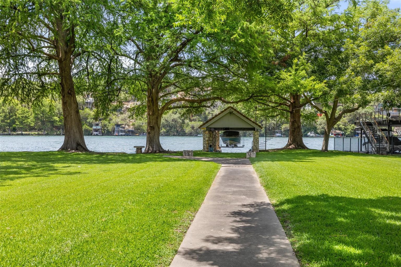
After representing buyers and sellers on 50+ Lake Austin waterfront transactions over 25 years, the single most important due diligence item is the dock. A home with a permitted, usable dock in deep water is worth $500K-$1M more than the same home with a shallow cove and permitting restrictions. We've saved clients from six-figure mistakes by catching dock issues before they went under contract.
Why Lake Austin Commands a Premium
Lake Austin's value proposition comes down to three factors that Lake Travis and other Hill Country lakes cannot match.
Proximity to downtown: Lake Austin shoreline in areas like Westlake Hills, the Rob Roy Peninsula, and close-in pockets of west Austin sit 10-25 minutes from downtown in normal traffic. For dual-income households who need to commute daily, this accessibility is a deciding factor. Lake Travis properties are typically 25-45 minutes from downtown.
Constant water level: As a run-of-river lake between two dams, Lake Austin maintains more stable water levels than Lake Travis (a flood-control reservoir). Your dock stays usable year-round in most locations. Lake Travis can drop 30+ feet during drought, leaving docks high and dry.
Scarcity: Twenty-two miles of total shoreline versus Lake Travis's 271 miles. Lake Austin's residential shoreline is fully developed - no new waterfront land is being created. When owners sell, it's typically after holding for 10-20+ years. Annual turnover of 15-25 properties across the entire lake means inventory is perpetually tight.
Shoreline Segments: Eastern, Central, and Western
Not all Lake Austin waterfront is equal. The lake's character changes significantly from east to west.
| Feature | Eastern Shore (Tom Miller to Loop 360) | Central (Loop 360 to Quinlan Park) | Western (Quinlan Park to Mansfield Dam) |
|---|---|---|---|
| Typical price (Q1 2026) | $3M-$15M+ | $2.5M-$8M | $2M-$6M |
| Commute to downtown | 10-15 min | 15-20 min | 20-30 min |
| Water character | Narrower, river-like, scenic | Wider coves, more open | Widest sections, deeper coves |
| Neighborhoods | Tarrytown, Westlake Hills, Rob Roy | Davenport Ranch, River Place | Steiner Ranch lake section, Comanche Trail |
| School district | Eanes ISD / Austin ISD | Eanes ISD / Austin ISD | Leander ISD |
| Dock depth (typical low) | 6-12 ft | 8-15 ft | 10-20 ft |
| Privacy level | Moderate (closer lots) | High (larger lots) | Highest (acreage) |
Eastern shore properties command the highest premiums because of downtown proximity and school district access (Eanes ISD or premium Austin ISD zones). Tarrytown waterfront is the rarest - fewer than 20 homes have direct lake access, and when one comes to market in the $3M-$8M range, it moves fast. Rob Roy Peninsula offers gated estates on 1-5+ acre lots with Eanes ISD.
Central shore provides a balance of price, privacy, and water quality. Coves tend to be wider and deeper. Davenport Ranch and surrounding areas offer 0.5-2 acre lots with established trees and hill views above the waterline.
Western shore is the best value for waterfront with the most water depth and the widest sections of the lake. The trade-off is commute time (20-30 minutes to downtown) and school district (Leander ISD instead of Eanes or Austin ISD).
Dock Permitting: The LCRA Process
Dock permitting is the most misunderstood aspect of Lake Austin real estate. The LCRA regulates all structures on and adjacent to the lake, and the permitting process can take 6-18 months.
What LCRA controls: Dock construction, dock modifications, boathouses, retaining walls, shoreline stabilization, and any structure within the LCRA-managed shoreline zone. You cannot build, expand, or significantly modify a dock without LCRA approval.
Key permitting factors:
- Water depth at the dock: LCRA requires minimum water depths for dock approval. Shallow coves or areas where the lake narrows may not support new docks.
- Existing dock status: A property with an existing permitted dock is far more valuable than one without. Confirm the dock's permit status is current and that it hasn't been modified without approval.
- Neighbor proximity: LCRA considers the impact on adjacent property owners. Dock size and placement must not unreasonably interfere with neighbors' access or views.
- Environmental impact: Cypress trees, nesting habitat, and shoreline vegetation are protected. Dock placement must accommodate existing environmental features.
What to verify before making an offer:
- Request the current LCRA dock permit and confirm it is active and in compliance.
- Confirm the dock's surveyed location matches the permit.
- Review any pending LCRA enforcement actions or violations.
- If there is no dock, engage an LCRA-experienced marine contractor to assess permitting feasibility BEFORE you go under contract.
- Verify water depth at the dock location during seasonal low periods, not just current conditions.
Water Depth and Seasonal Conditions
Lake Austin's constant-level designation does not mean water levels never change. LCRA manages the lake for downstream water supply and power generation, and levels can fluctuate 2-4 feet depending on rainfall and operational needs.
What this means for dock usability: In shallow coves on the eastern end, a 2-foot drop can reduce dock depth from 6 feet to 4 feet - potentially unusable for larger boats. In deeper central and western sections, the same drop is manageable.
How to evaluate: Ask for historical lake level data for the specific cove. Visit the property during different seasons. Check LCRA's online lake level monitoring. A marine surveyor can measure depth at the dock and mark seasonal minimums. Budget $500-$1,000 for a professional depth and shoreline survey.
Shoreline Types and Their Impact
Lake Austin shoreline falls into three main categories, each with different maintenance and value implications.
Rock/limestone bluff: The most desirable and lowest maintenance. Provides stable elevation above water with natural erosion resistance. Common on the central and western portions. Premium pricing.
Gradual slope with trees: Mixed terrain with a walk-down approach to the water. Requires periodic erosion management and possibly retaining walls. Common on the eastern shore. Moderate premium.
Low-lying/flat: Closest to water level, which means easier water access but higher flood exposure. May require flood insurance even outside the FEMA-designated zone. Check elevation certificates carefully. These lots trade at lower premiums per linear foot of shoreline.
Flood Insurance and Risk
Lake Austin is a LCRA-managed dam-controlled lake, but flood risk exists. Key considerations:
FEMA flood zones: Some Lake Austin properties fall within FEMA-designated flood zones, which requires flood insurance if you have a mortgage. Properties above the 100-year floodplain may not require it, but voluntary coverage is still recommended.
Elevation certificates: Obtain a current elevation certificate for any property you are considering. This determines your FEMA zone designation and insurance premium. The cost of flood insurance can range from $500/year for well-elevated properties to $5,000+/year for lower-lying lots.
Historical flood data: Austin experienced significant flooding events in 2013, 2015, and 2018. While Lake Austin's dam management prevents the extreme swings of Lake Travis, localized flooding from tributaries and drainage can impact specific properties. Review historical data for your cove and shoreline.
Price Tiers: What Your Budget Buys on Lake Austin
$2.5M-$4M: Older builds (1980s-90s) with dock access, typically 2,500-3,500 sq ft on the western or central shore. May need renovation. Smaller lots (0.25-0.5 acres). These represent the entry point to Lake Austin waterfront.
$4M-$7M: Updated or renovated homes, 3,500-5,000 sq ft, with private dock and established landscaping. Central shore or premium eastern shore locations. 0.5-1.5 acre lots. This is where most Lake Austin transactions occur.
$7M-$12M: Luxury estates with 5,000-8,000 sq ft, pool, guest house, premium dock setup. Eastern shore in Rob Roy or Westlake. Eanes ISD. 1-3 acre lots with significant privacy and mature trees.
$12M+: Compound-style properties with multiple structures, deep-water docks, boat lifts, and exceptional views. These are legacy properties that trade infrequently and often sell through private channels before reaching the public market.
The Constant-Level Advantage
Lake Austin's constant-level status is its single greatest differentiator from Lake Travis and every other Highland Lakes property. Here is what it means in practice:
- Your dock stays functional 365 days a year in most locations
- Shoreline landscaping remains viable at consistent water levels
- Property values are insulated from the "drought discount" that hits Lake Travis when water levels drop
- Your views remain consistent - no exposed lake bed or receding waterlines
- Insurance premiums are generally lower than fluctuating-level lakes
The trade-off is Lake Austin's smaller size and more residential character. You will not find the resort-style marinas, open-water boating, or party coves that Lake Travis offers. Lake Austin is a scenic cruising, paddle sport, and evening pontoon lake - not a wakeboarding and high-speed boating lake.
Due Diligence Checklist for Lake Austin Buyers
- Dock status: Confirm LCRA permit is current and in compliance. Verify depth at dock during seasonal lows.
- FEMA zone and elevation: Obtain elevation certificate. Determine flood insurance requirements and cost.
- Shoreline condition: Inspect for erosion, retaining wall integrity, and drainage patterns. Budget for maintenance.
- Water depth survey: Hire a marine surveyor ($500-$1,000) to measure depth at the dock and map the cove bottom.
- HOA and deed restrictions: Review rules on dock size, boat type, exterior modifications, and guest access.
- Utilities: Confirm municipal sewer vs septic. Septic systems affect renovation options and long-term maintenance cost.
- School district: Verify address-level school assignments. Eastern and central shores may be Eanes ISD or Austin ISD depending on exact location.
- Commute testing: Drive routes during peak hours. MoPac, Loop 360, and Bee Caves Road all have rush hour congestion.
- Insurance: Get flood, homeowner's, and watercraft insurance quotes BEFORE making an offer. Waterfront premiums vary significantly.
- LCRA easements: Review the property survey for any LCRA access easements that could affect your use of the shoreline.
Frequently Asked Questions
How much do Lake Austin waterfront homes cost?
Do I need a permit to build a dock on Lake Austin?
How does Lake Austin compare to Lake Travis for waterfront homes?
What is the biggest risk when buying Lake Austin waterfront?
Do Lake Austin waterfront homes require flood insurance?
Contact us for a Lake Austin waterfront consultation: 512-415-7653 | keenan@compass.com
Ready to take the next step? Browse active Lake Austin waterfront listings to see what is on the market right now. Get a home valuation if you are considering selling, explore buyer resources if you are searching, or review the Keenan Group's track record across 1,000+ Austin transactions.
Interested in Tarrytown?
Get a confidential market brief for Tarrytown with current inventory, pricing, and strategy recommendations from Austin's #1 team.